An up-to-date, fast and improved reporting system, e.g. The GIS/GPS technology can be used to provide accurate and credible land demarcation for foresters and farmers
Our clients/customers realize an improved optimal or appropriate allocation of their scarce but valuable resources.
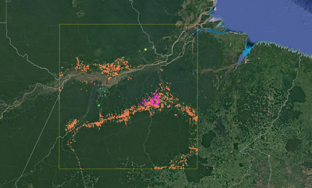
A transparent accountability using the GPS/GIS technology. E.g. A mapping result reveals accurate location of project area or intervention areas and detailed sites where funds were donated. This enhances the understanding between donors and implementers about the appropriate allocation of their funds. Also a tree planter will know how many seedlings are need for the known acreage of land that has been mapped. How many people to be employed per ha for a piece work (Man Days) is possible to decide.
Income level mapping; this helps the manufacturing companies to target their marketing/sales campaign so salespersons legitimately move to the appropriate buyers of the products/services.
We also provide business solutions or intelligence in decision making for resource allocation, e.g. to an entrepreneur we located where other schools, filing stations, or health centers are located for his business intension to establish the next school. This is done with an optimal price possible basing on various factors such as slope, soil types, distance from the next school, population, cost of leveling the slopes, etc. This is referred to as Spatial Analysis and or modeling.
We also integrate forest inventory with GIS/GPS and Remote sensing technology to estimate Carbon/Biomass sinks. This applies to companies or institutions that plant trees for carbon trading.
We deploy web mapping applications to display the interiors, external, ground floor designs, surroundings of real estates and other manufacturing and companies that transact online
Also, development agencies deploy our services to obtain assurance that resources are expended on intended purposes and for optimal value. Our focus is on building capacity in participatory GIS through developing systems and processes and enhancing institutional resources management.